


How to Climb Ben Nevis
EVERYTHING YOU NEED TO KNOW ABOUT THE MIGHTY BEN NEVIS!
The legendary Ben Nevis stands at 1345m tall – the highest mountain in the British Isles and a peak on many adventurer’s bucket lists! Over 100,000 people reach the summit every year, however an ascent up Ben Nevis should never be taken lightly - the mountain is famous for its unpredictable weather.
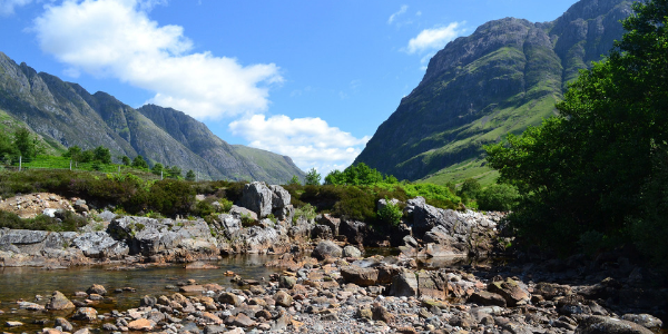
As well as it’s ever changing weather, Ben Nevis is also famous for its incredible views across the surrounding countryside, attracting both experienced hikers and trekking newbies alike! If you’d like to climb Ben Nevis and experience the stunning highlands, here’s how to do it …
WHEN SHOULD I CLIMB BEN NEVIS?
If you are an amateur walker, then you should only hike Ben Nevis during the summer months (June-September). Snow is often seen at the summit all year round, however during winter months the mountain is likely to be thick in snow and ice, covering the paths and making the journey to the top extremely dangerous.
Prior to setting off you should always double check the weather forecast. A day in June and July may feel like a lovely summer’s day at the bottom of the mountain, however by the time you reach the summit it can feel just like winter. The average annual temperature at the summit is below 0°! Therefore, it is so important to make sure you are fully prepared before setting off. Check out our Adventure Journal post, What Do I Need to Climb Ben Nevis, for a full list of packing essentials!
Also, avoid trekking to the summit of Ben Nevis alone, ensure someone knows where you are going, what route and when you should be back and finally make sure you register your mobile phone with 999 for text messages (more information on this can be found HERE).
WHERE IS BEN NEVIS?
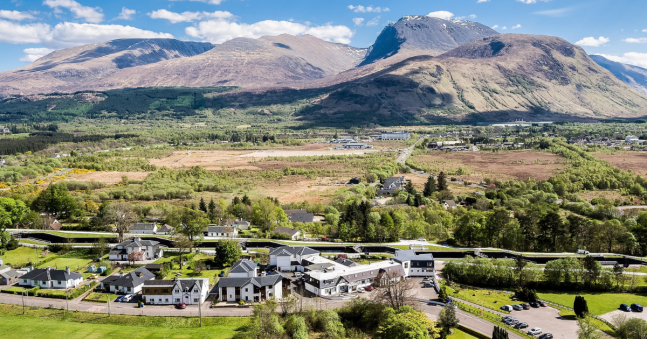
Ben Nevis is located near the town of Fort William, three hours north of Glasgow, and is part of the Grampian Mountain Range.
Parking is available at The Glen Nevis Visitor Centre car park, located approximately 1.5 miles from Fort William, at a cost of £3 per day (or £10 for a motorhome). The postcode - PH33 6PF, will get you in close proximity of the car park, but you will need to continue along the road (away from Fort William) for approximately 1 mile. Use Latitude: 56°48'38.90"N Longitude: 5°4'38.17"W for a more accurate location.
If you are looking to climb Ben Nevis via the more challenging Carn Mor Dearg Arete route, then you can park at the North Face car park, located 1 mile from Torlundy. The postcode PH33 6SW will take you to the turning for Torlundy. For a more accurate location use Latitude: 56°50'31.07"N Longitude: 5°2'35.02"W.
WHAT ROUTE SHOULD I TAKE TO THE SUMMIT?
There are two main routes to the top of Ben Nevis, both varying in difficulty. The Mountain Path is the route taken by the majority of visitors, whilst the Carn Mor Dearg Arete route is a much more challenging route, involving a long scramble along the traverse of the arete.
The Carn Mor Dearg Arete route is challenging, but spectacular route involves 1506m of ascent and a total walking distance of 17.5km. This is a tough ascent – and should only be taken by experienced trekkers.
We highly recommend trekking to the summit of Ben Nevis via The Mountain Track.
Climbing Ben Nevis via The Mountain Track
The Mountain Track to the summit of Ben Nevis, also known as the Tourist Route, is the most popular route of ascent. This track was originally called the Pony Trak, as it was built in the 19th century for the ponies to carry supplies up to the meteorological observatory on the summit, which is now in ruins. In total this route is 17km, with an ascent of 1370 metres- taking approximately 6-7 hours to complete.
The Route
Starting at The Glen Nevis visitor centre, cross the footbridge over the river and follow a well-marked out path to join The Mountain Track. From here the path climbs steeply up some steps, before gradually evening out to a more moderate climb.
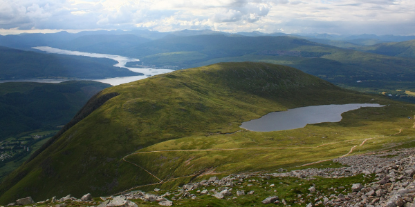
The path continues to wind its way up the mountain, with many fantastic views along the way (get your camera ready!). You will eventually reach the Halfway Lake at 570m, a great spot to have a break and keep hydrated. Continuing on, the terrain will change from lush green landscapes to grey rocky surroundings. Continue up the path, zig-zagging its way up the mountain – in bad weather conditions, visibility can become poor, so make sure you keep to the path.
Eventually, after hiking up some scree, you will reach the summit of the UK’s highest peak! At the summit you will find several memorials, a trig point and many cairns. On a clear day you will be able to see for miles and miles – the surrounding mountains, lochs and cliffs are an incredible sight!
After taking in the amazing views, descend back down the mountain via the same route, with a great sense of achievement at conquering The Ben!
JOIN THE ADVENTURE
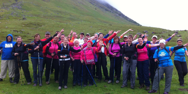
Are you looking to climb Ben Nevis with a group of fellow adventurers, whilst raising money for the charity of your choice? Then why not join us on our Ben Nevis trekking adventure!
Meeting in Glasgow we transfer to Fort William, before enjoying an evening meal and briefing. After a hearty breakfast we then begin our ascent up The Mountain Track, taking approximately 4 hours. Upon reaching the summit we can enjoy a well-earned lunch and take in the stunning surrounding views.
The descent will take approximately 3 hours, and upon return, we will enjoy a celebratory dinner and drinks – reflecting on our adventure with new friends. The following day we will enjoy breakfast together before a transfer back to Glasgow, where we say goodbye to our fellow adventurers!
Related Blogs -
- What Do I Need to Climb Ben Nevis?
- Three Peaks Challenge Top Tips
- What Is the Highest Mountain in the UK?
Share this with your friends


